
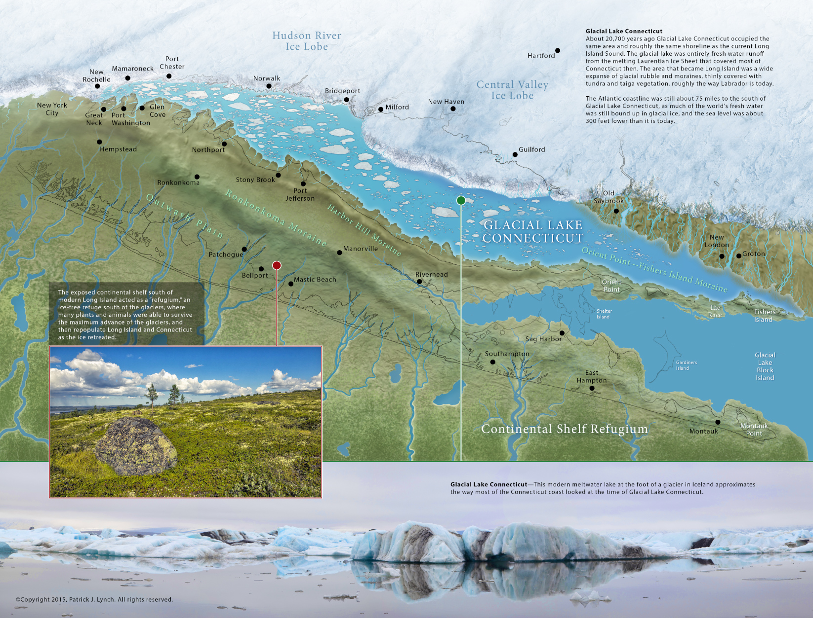
For an upcoming book project I’ve been working with Ralph Lewis, the former Connecticut state geologist on making my LIS geology maps and figures more accurate. Lordship and Stratford Point stick out so far in the Sound because the area was a wedge (moraine and outwash river fan) between two giant ice sheet lobes, the Hudson River and Connecticut Valley lobes. Note the sharp turn in the ice edge at the Lordship – Stratford Point area. The CT Valley lobe flowed more freely, and was slower to melt back. This shows the ice edge at 20,700 calendar years ago.
